The Cartographies of Catastrophes
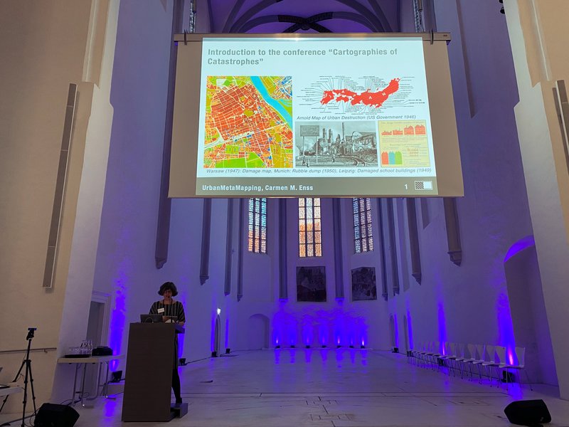
Bamberg, 23.–24. November 2021
The conference at the Bamberg University examined maps and other related methods of documenting urban destruction in different temporal and spatial contexts: from 19th century Central Asia to contemporary Spain.
Firstly, there was a strong focus on the content of the maps themselves and the question of whose perspectives are portrayed in the maps? Whose views are championed? We can think of them as maps of arguments or argumentation. For example, Mohamed Fareed (Cairo) argued that maps of East Jerusalem are used as tools to communicate narratives of the past and claims to space, whereas in the case of Calcutta Subhasree Ghosh showed how these complex and multilayered narratives and realities were obscured, omitted and therefore hidden from conventional maps. Similarly, examples from Polish cities destroyed during the Second World War, Warsaw (Anna Seidel) and Frampol (Noemi Quagliati), challenged the idea of ‘truthful documentation’, by confronting those depictions with an analysis of literary and photodocumentary sources. Aleksandra Szczepan brought to the discussion the personal perspective of the Holocaust survivors, whose hand-drawn maps based on their memories, differed sharply from the technocratic and precise maps of their oppressors.
During the discussion the notion of counter cartography or counter-mapping emerged. This is described as a form of mapping which aims to map the world from marginalized perspectives. It is a form of socio-political mapping in contested space, linked to power and territory. In the case of East Jerusalem, maps of the old city prepared on the one-hand by the Israelis and on the other-hand by the Palestinians show the disputed claims to the city and are interpreted as unspoken, explicit attempts to destroy the others’ claims to identity.
Secondly, maps of destructions were often intimately bound with the vision for reconstruction. There was a consistent idea that reconstruction should represent an improvement on what was there before, with straplines such as “Build back better” in the UK, and the will to remove inner-city slum areas, which were deemed unhygienic and breeding grounds for infectious diseases (John Pendlebury and Peter J. Larkham). The 1947 Town and Country Planning Act in the UK, for example, led to more technical, technocratic mapping, and as a result, became more removed from public involvement and scrutiny. Moreover, while the postwar period was a period of rapid transformation, we need to remember that many plans had a long, 20–50-year implementation period. Cleared bomb sites therefore became part of the urban landscape for decades in many cities and often serious redevelopment and modernization did not commence until the 1970s, as in the case of Rijeka’s old town (Gruia Bădescu). Finally, in discussing the legacy of the reconstruction process another important point we shouldn’t forget is that the war also left a legacy on unbombed towns, which did not want to be left behind socially or economically and aspired to modernization expressed in the reconstruction plans of the war-torn cities (Peter J. Larkham).
The context and implementation of plans was not only marked by radical and utopian comprehensive development plans inspired by the international modernism movement of the pre-war period but also high pragmatism. Barbara Szczepańska argued that despite the ostentatious anti-German rhetoric in the post-war Opole, pre-war German plans not only for individual buildings, but also for the whole city were appreciated and appropriated by the new Polish administration.
Thirdly, the conference problematized the documentation of destruction in a historical context, starting with the French mission to Greece in the 19th century (Eleni Gkadolou) until the 20th monuments destruction in Soviet Russia (Anna Vyazemtseva). In the Greek case, the French experts documenting destruction in the newly established kingdom aspired the technical mastery and scientific objectivity, but their maps revealed as much as they concealed, as the categories used were not really explained or precise, but rather applied to in a generalizing manner. The 19th century imperial methodology was also examined by Inessa Kouteinikova, this time in the context of the Russian Turkmenistan and focused on the precise issue of what such sources do not show. Anna Vyazemtseva’s presentation focused on Alexei Schusev's drawings, which in her view are an essential tool to understand the destruction in Istra, due to the lack of reliable cartographic data available. Nicolás Mariné’s presentation also questioned the existing maps of war destruction, but this time in the context of the Spanish civil war. Using digital technologies allows one to re-examine the frontline in the surroundings of Madrid and reconceptualize the cultural landscape of the war. Finally, Lora Sariaslan provided an insight into how a contemporary Turkish artist uses language of cartography and map-making for his works, which challenges the familiar categories of borders and patterns.
Last but not least, Stefanie Plappert from the German Film Museum took the participants of the conference on the virtual tour of the exhibition “Catastrophe. What Comes after the End?” which is currently in Frankfurt am Main. Fictional depiction of large-scale disasters not only was a fascinating counterpart to the scientific discussions, but also invited the participants to reflect on narrative frames used to present “catastrophes”.